Difficulty: Insane
Rating: 5/5
Duration: 5-6hr / 5.5km (one-way)
Accessibility: 4x4 high clearance
stein valley (brimful lake)


Description:
The Stein Valley to Brimful Lake trail is hands down our favourite hiking destination of 2017 and possibly of all-time. The remoteness of this area means you should find yourself completely isolated, as on our 4-day trip we didn't see a single person, a piece of trash, or any sign of human activity in the area. If you are planning on visiting the area, do your best to leave only footprints and keep this area as pristine as you found it. We recommend planning to stay overnight at least, even a few nights. For the camping gear we recommend, check out our GEAR page.
A solid 4x4 vehicle with high clearance is required for this trip, even us with our Jeep had to stop roughly 2km before the trailhead since the cross trenches get too deep to pass.
Finding the trailhead is one of the trickiest parts of this hike. The area hosting the trailhead has recently been logged out so any previous markings are now gone. When you reach the end of the final fork you should see some white paint on the ground which leads up to the trailhead on the edge of the forest, marked with orange ribbon. The orange ribbons were done by us, so if you're following those you know you're on track. From here on the trail becomes much clearer. As the trail is rarely maintained you may find yourself climbing over a lot of deadfalls. Proceeding in the sub-alpine area you will come across a few creek crossings. It is a good idea to fill up any water here since it is your last chance before reaching the lake. Make sure you have a water filter for this, check out our GEAR page for what we recommend.
You will soon pop out of the tree line where you will be faced with a tough scramble up the loose rock path. Once at the top you should see a "Park Boundary" sign. From here the path continues up to the left then around the mountain through a large boulder field. The path in this area is very vague, but is roughly marked with inuksuks and orange ribbon. Once through this, the path will become clearer and begin to head downhill as you make your way around the mountain towards the lake.
Once reaching the lake and making camp be sure to take advantage of the bear box located near the stream coming off the lake. This area is notorious for bears and is shutdown in the early season to allow for this. Remember to practice safe backpacking techniques bringing bear spray, making plenty of noise, and stashing any food down-wind from your camp. For what backpack we recommend use our GEAR page.
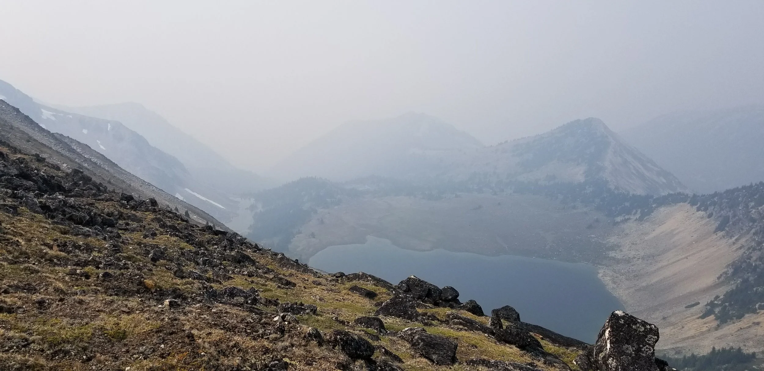
Once you've set up camp this area is perfect for making small day trips up the surrounding peaks. If you head up the mountain on the far side of the lake you'll have access to several peaks with views of the Rainbow Ridge jutting out ahead of you.
Directions:
This hike is approximately 4 hours 25 minutes drive from Kelowna, 4 hours 15 minutes from Vancouver, or 45 minutes from Lillooet.
- Coming from Lillooet, head South on Texas Creek rd, off of Duffey Lake rd (Highway 99).
- Follow Texas Creek rd for 17.8km until you come to a small bridge.
- Just before the bridge turn right onto Texas Creek FSR.
- Reset your odometer and follow this road up the narrow canyon.
- At 3.8km you'll pass a turnoff on your right going downhill to a small campsite.
- At 4.4km you'll pass a gate which is closed between April 15 and June 30 due to the high amount of Grizzly bears in the area.
- Keep left at 7.4km.
- At 12km stay to the right.
- Keep left at 16.5km ignoring the rougher road to the right.
- Shallow ditches will begin around the 19km mark. Drive as far as your vehicle allows, then walk the remainder of the road. High clearance is required.
- At around 21km there is fork in the road, take the right path going over some deep cross trenches.
- At the end of this path you'll reach a cleared out forestry area. The trailhead is very hard to find but it is loosely marked with white paint through the clear-cut area. It starts roughly here: 50.417825, -121.943790
- Once you reach the forests edge the trail becomes clearer and is routinely marked with orange ribbon. Approximately located here: 50.417140, -121.946074
Click to view this route on GoogleMaps!
*Note the GoogleMaps link will only take you as far as the Texas Creek FSR turnoff, follow the remaining directions to reach the trailhead.
GPS Coordinates:
- Texas Creek FSR turnoff: 50.558272, -121.827907
- First junction: 50.43567 -121.93706
- Second junction: 50.42257 -121.93850
- Trailhead: 50.417825, -121.943790
- Forest Trailhead: 50.417140, -121.946074
Start of meadows: 50.41158 -121.95143
Creek crossing: 50.41109 -121.95444
Stein Divide / Provincial Park boundary: 50.41115 -121.96803
Trail leaves ridge: 50.40978 -121.96804
Trail begins descending towards lake: 50.39821 -121.97276
Brimful Lake campsite: 50.39391 -121.96721
Notes:
- There is absolutely no cell service, so its very important to come prepared with either pre-downloaded or paper maps.
- When we made our trip in August 2017 we routinely marked off the trail we took with orange ribbon.
Features:
- Creek crossings
- Water sources
- Lakes
- Summits
- Mountain views
- Boulder fields
- Canyon
- Camping area
- Bear box
- Outdoor toilet
- No cell service